Local areas are systems of people and places that have much in common socially, economically and ecologically. They are also known as social-ecological systems or sub-catchment areas.
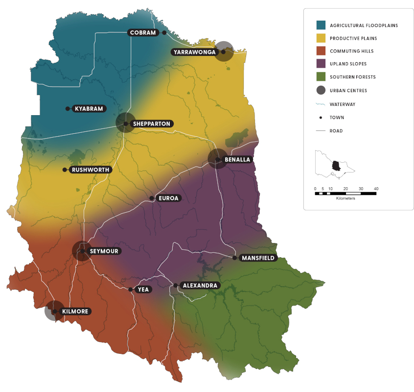
Figure 17 shows the 6 local areas for the strategy.
These local areas reflect the catchment’s social and biophysical systems, community priorities and interests, and highlight the connection of land, water, biodiversity and community. Figure 17 also shows the connection between local areas, rather than sharp boundaries.
Developed previously, these local areas are still considered appropriate given community feedback and insights from a socio-economic analysis of ABS census data.
Local areas are useful for strategic planning as they allow outcomes and priority actions to closely match local drivers of change, land use and community interests while still contributing to catchment-wide outcomes.
Click the local area links or the map (Figure 17) for information about current condition, drivers of change, community vision and outcomes and future direction.

Figure 17: The 6 local areas of the Goulburn Broken Catchment
Show your support
Pledge your support for the Goulburn Broken Regional Catchment Strategy and its implementation.


